
Accurate Data. Elevated Perspective.
Advanced Surveying & Spatial Data Services
Stonebridge Survey provides professional surveying services that deliver accurate, reliable spatial data for projects of all sizes. Through LiDAR & Surface Scanning, Aerial Photogrammetry, and Site Intelligence & Set Out, we help clients plan, build, document, and manage projects with confidence. Using advanced technology and industry-leading software, our team provides the accurate information needed to support informed decisions from planning through project completion.
Our Services
LiDAR & Surface
Scanning
High-resolution spatial data for projects that demand precision and efficiency. We capture millions of data points to create detailed 3D models, terrain maps, contour lines, and digital elevation data, even in densely vegetated or difficult-to-access area.
Aerial
Photogrammetry
Cost-effective scanning and surveying solutions using high-resolution drone imagery. By capturing overlapping aerial photographs, which provide geo-referenced data that can be used in a wide range of applications.

Site Intelligence
& Set Out
Precise field staking and layout solutions to ensure your project is built exactly as designed. Using advanced surveying equipment and geospatial data, we accurately transfer engineering and construction plans from digital drawings to physical locations on the ground.
Trusted Survey Partner for Complex Environments
Projects Surveyed
Acres Surveyed
Flight Hours logged
Project Deliverables Produced
Stonebridge Survey delivers high-accuracy spatial data capture and measurement services to support the full lifecycle of physical environments. We combine advanced reality capture and traditional surveying methods to turn real-world conditions into accurate digital datasets and translate plans into measurable, build-ready information. Our work provides the clarity needed across planning, design, execution, and verification.









OUR PROJECTS
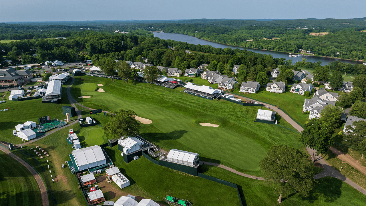
Where Accurate Data Meets Project Success
.jpg)
Commonly Asked Questions
We work with event owners, production companies, and venues worldwide. Here are answers to questions we hear most often from new clients.
Stonebridge Survey supports projects of all sizes across construction, infrastructure, commercial development, energy, transportation, and major sporting events. Our team provides survey solutions from pre-construction through project completion, delivering accurate data that keeps projects moving forward.
Not sure which service is right for your project? We’re here to help. Stonebridge Survey offers three core service areas to support projects at every stage:
• LiDAR & Surface Scanning – Captures highly accurate 3D spatial data to document existing conditions, terrain, structures, and other project features, even in complex or difficult-to-access environments.
• Aerial Photogrammetry – Uses high-resolution aerial imagery to create detailed maps, orthomosaics, 3D models, and site documentation for planning, progress tracking, and project visualization.
• Site Intelligence & Set Out – Provides accurate field layout for construction and detailed site documentation through as-built surveys, helping teams verify installations, coordinate work, and keep projects on schedule.
If you’re unsure which service best fits your project, contact our team. We’ll recommend the right solution based on your project’s goals, timeline, and site requirements.
LiDAR (Light Detection and Ranging) is a technology that captures millions of accurate 3D data points to create a detailed digital representation of your site. It’s ideal for documenting existing conditions, mapping terrain, and collecting accurate spatial data in areas where traditional surveying may be more challenging.
Whether you’re planning a project, monitoring construction, or documenting completed work, Stonebridge Survey’s LiDAR & Surface Scanning services provide the reliable data needed to support better decisions every step of the way.
Absolutely. We regularly collaborate with surveyors, engineers, contractors, architects, and project managers. Whether we’re providing specialized aerial services, site intelligence, or supplemental survey support, our team integrates seamlessly into existing workflows to help keep projects on schedule.
While both technologies capture accurate site data, they do so in different ways. LiDAR uses laser pulses to collect precise three-dimensional measurements and performs well in heavily vegetated or complex environments. Aerial Photogrammetry uses overlapping high-resolution imagery to create detailed maps, orthomosaics, and 3D models. Depending on your project’s goals, Stonebridge Survey can recommend the most effective solution or combine both technologies for the best results.
both?
The right solution depends on your project’s goals, site conditions, and required deliverables. LiDAR is ideal for capturing highly accurate 3D spatial data, especially in complex or heavily vegetated environments. Aerial Photogrammetry provides detailed imagery for maps, orthomosaics, and 3D models. In many cases, combining both technologies delivers the most complete picture of a site. Our team will recommend the best approach based on your project’s needs.
Site Intelligence & Set Out services support projects from construction through completion. Set Out ensures infrastructure is installed in the correct location by accurately transferring design plans to the field. Site Intelligence documents existing or completed site conditions through accurate spatial data and as-built surveys, helping teams verify work, improve coordination, and maintain reliable project records.
Aerial Photogrammetry uses overlapping high-resolution images to create accurate maps, orthomosaics, 3D models, and other site deliverables. It’s an efficient solution for documenting existing conditions, monitoring project progress, calculating volumes, and capturing large areas quickly. It’s ideal for projects that require detailed visual documentation and accurate spatial data.
Ready to work on your next project?
Whether you’re planning a large development, monitoring a construction site, or inspecting infrastructure, we deliver the aerial precision your project demands.